Nationwide Coverage
We have executed projects in multiple states and communities across Nigeria, spanning all geopolitical zones.
Discos We Have Served
A record of major distribution companies we have partnered with, and the key services we delivered on each engagement.


Portfolio: GIS & Network Mapping
A selection of real deliverables from our field operations, produced using ArcGIS for major electricity distribution companies across Nigeria.
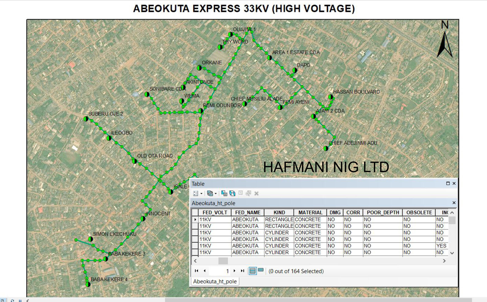
Abeokuta Express 33KV Network Mapping
Full GPS mapping of the Abeokuta Express 33KV high-voltage feeder, covering poles and substation connections across the city. The attribute table records 164 poles with material type, voltage, condition status and connectivity data for each asset.
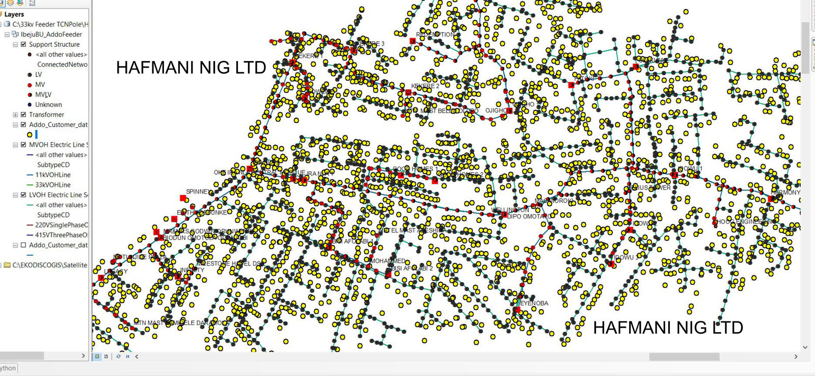
Ibeju BU Addo Feeder, Full Network Hierarchy
A comprehensive multi-layer network map for the Addo Feeder in the Ibeju Business Unit, capturing the complete distribution hierarchy from 33KV high tension lines down through distribution transformers, low-tension poles and individual customer connection points.
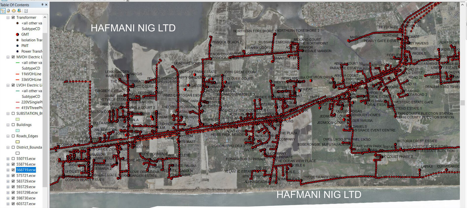
Ibeju Business Unit, Full Asset Coverage
Spatial mapping of all distribution assets across the Ibeju Business Unit, overlaid on high-resolution satellite imagery. The map shows the complete MV and LV network including all transformer locations, covering the Lekki corridor and surrounding areas.
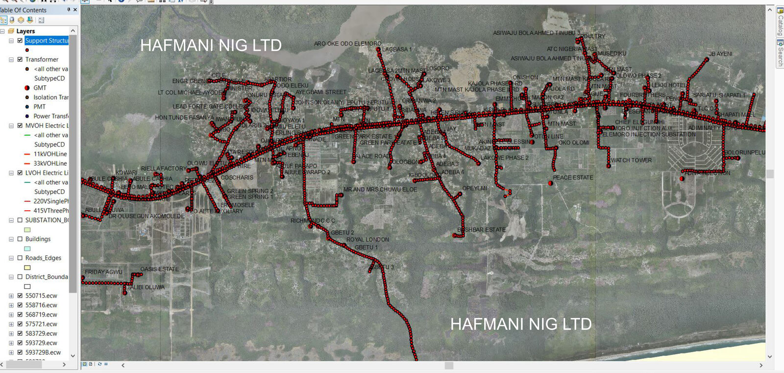
Ibeju and Eleko Feeders, Parallel Route Mapping
Detailed mapping of the Ibeju and Eleko feeders running through shared corridors, with all transformer positions recorded. The map covers a long stretch of coastline infrastructure and inland communities, showing both 11KV and 33KV overhead lines.
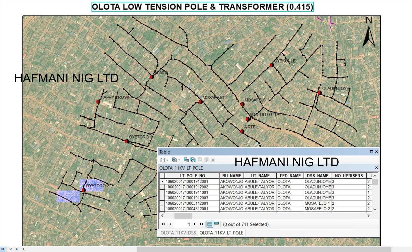
Olota LV Pole and Distribution Transformer Survey
Systematic GPS survey and attribute capture of 711 low-tension poles and distribution transformers across the Olota network. Each pole is recorded with its LT pole number, business unit, feeder, DSS name and number of uprisers, supporting full lifecycle and maintenance planning.
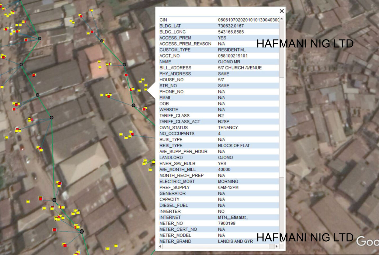
Geo-Referenced Customer Database
Field-collected customer records linked directly to GPS coordinates and network assets. Each entry captures name, address, tariff class, meter number, occupancy type and billing details, enabling DisCos to link every customer to their supply point for accurate billing and revenue assurance.
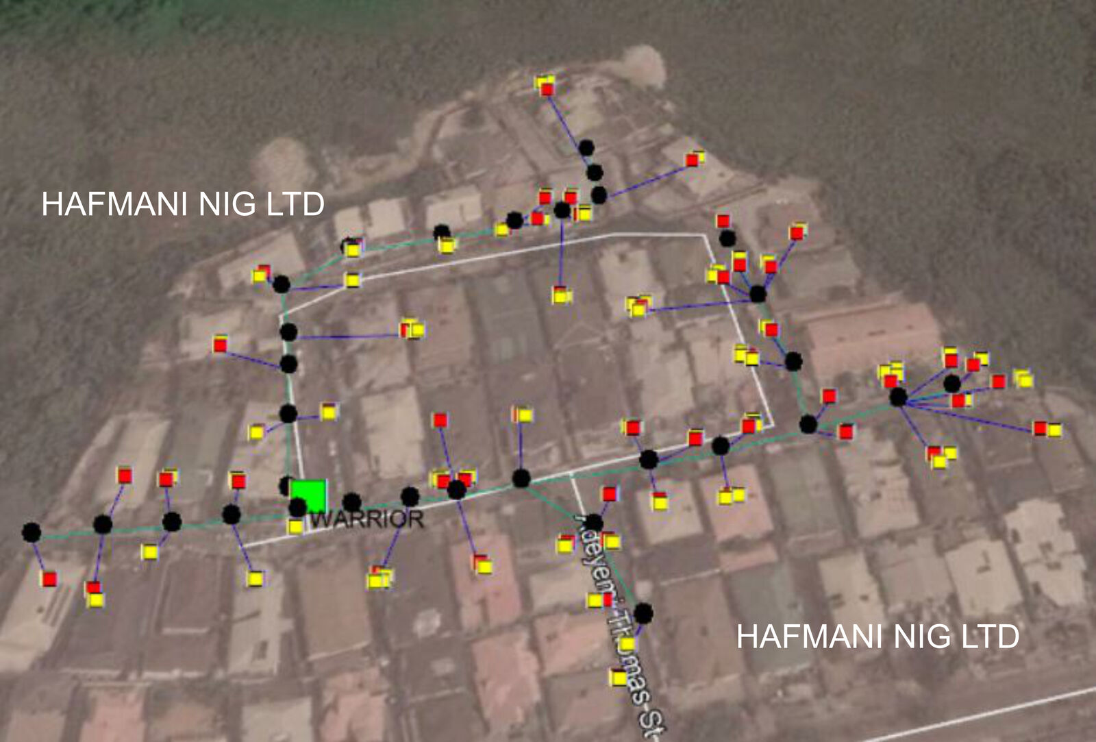
Warrior Distribution Substation (DSS)
Detailed mapping of the Warrior DSS and its entire low-voltage distribution network, showing the substation, feeder poles and customer meter points on aerial imagery. The output supports fault tracing, load balancing and revenue recovery for the substation's service area.
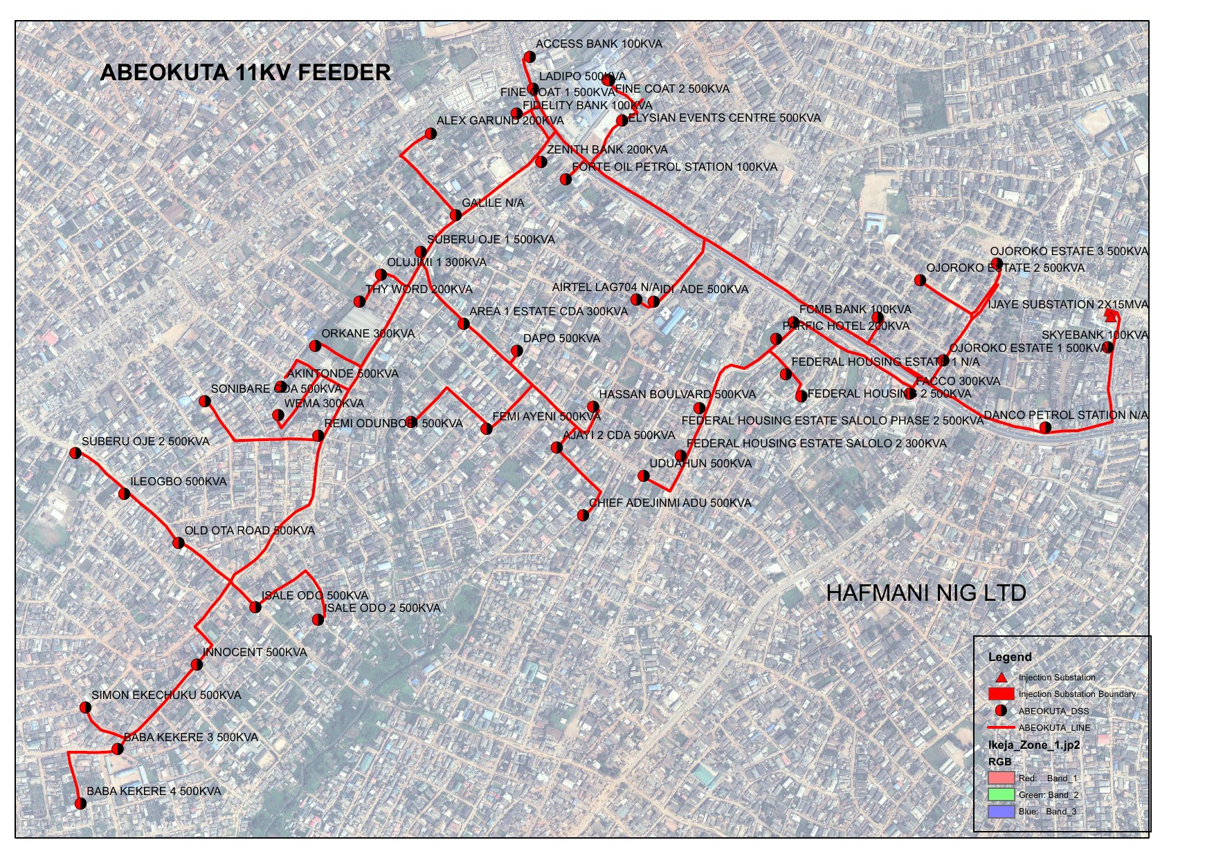
Abeokuta 11KV Feeder, Distribution Substation Map
Print-ready map of the Abeokuta 11KV feeder showing every distribution substation along the route, with transformer capacities ranging from 100KVA to 500KVA. Named load points include banks, estates, petrol stations and community facilities, with a full legend and injection substation boundary.
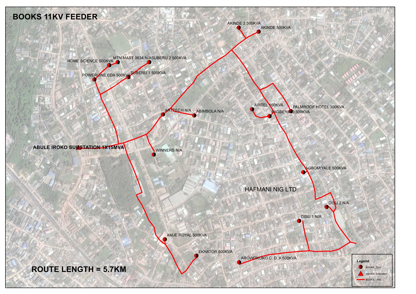
Books 11KV Feeder, Route and Substation Mapping
Mapping of the Books 11KV feeder with a total measured route length of 5.7KM, fed from the Abule Iroko Injection Substation (1x15MVA). All distribution substations are labelled with capacity and the complete feeder boundary is shown on satellite imagery with a clear legend.
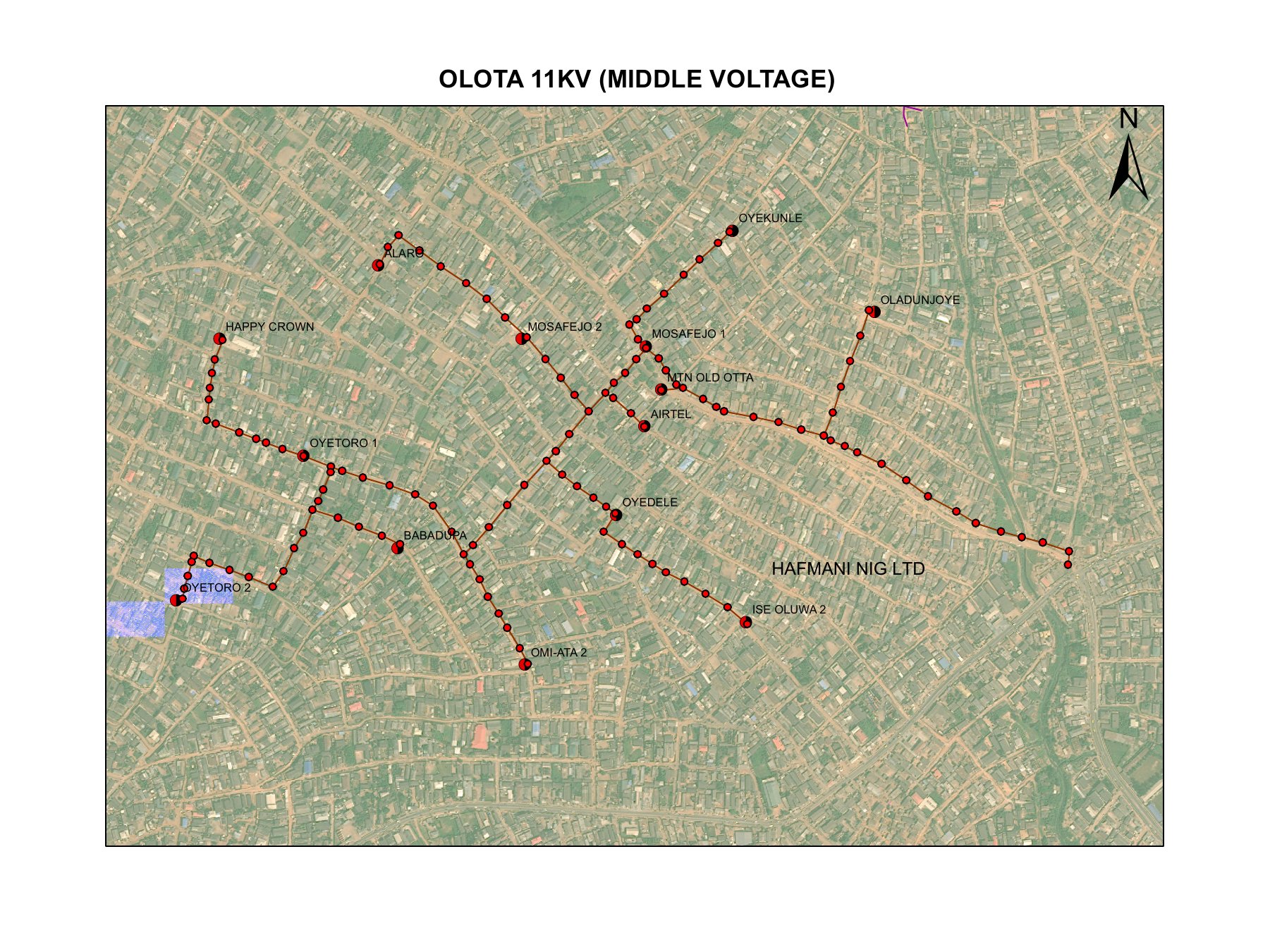
Olota 11KV Middle Voltage Feeder
Clean cartographic output of the Olota 11KV middle-voltage feeder covering multiple communities. Distribution substation locations are mapped across the full feeder corridor, providing a clear picture of network reach and load distribution for planning and maintenance purposes.
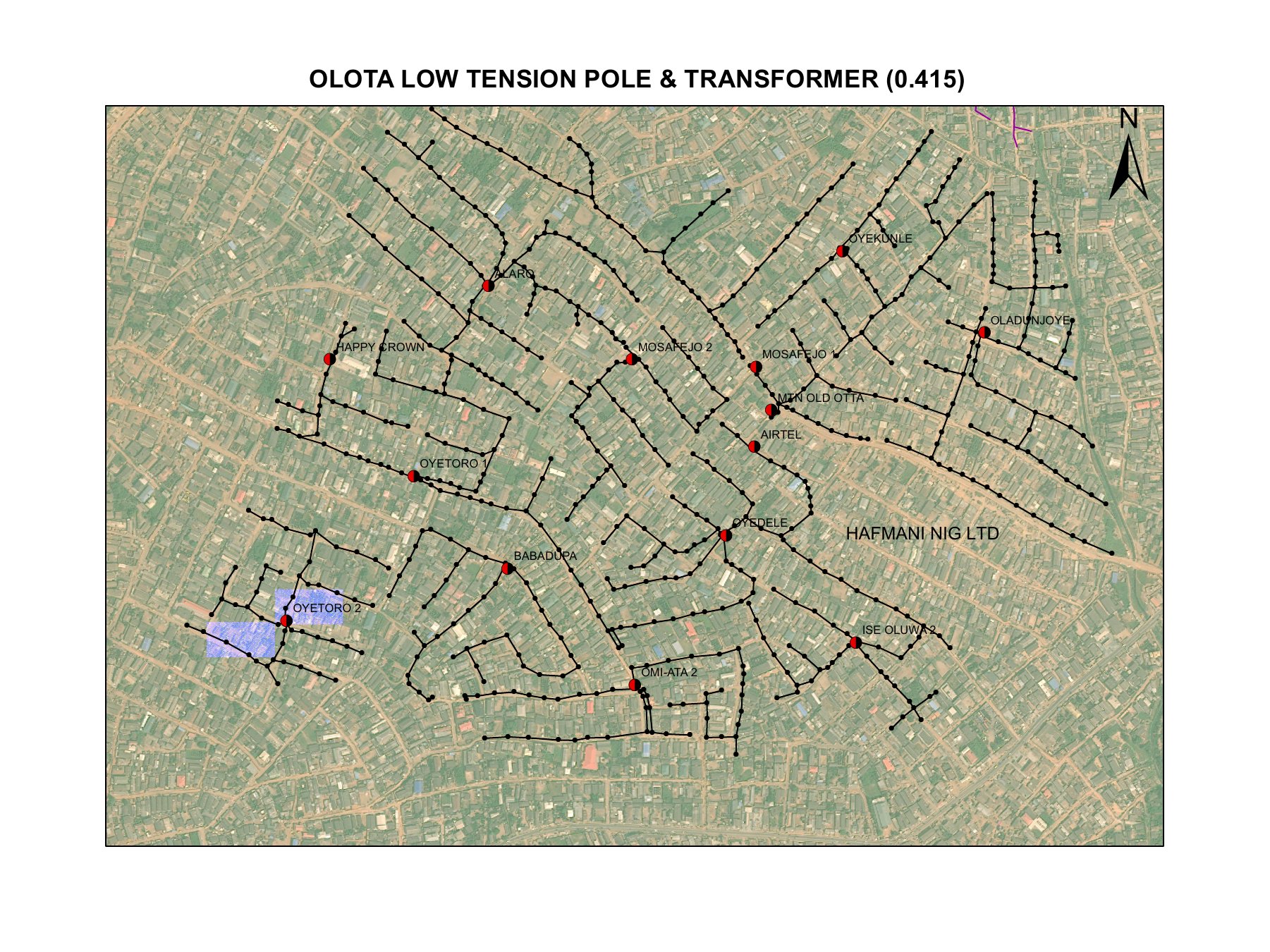
Olota LV Network, Print-Ready Cartographic Output
The final print-ready deliverable of the Olota low-tension network, showing the full LV pole network and distribution transformer positions across the entire service area. This level of detail supports maintenance scheduling, fault isolation and infrastructure investment decisions at the community level.
Who We Work With
Our work spans public utilities, private organisations, and government bodies across Nigeria's energy and infrastructure landscape.
Electricity Distribution Companies
All major Discos in Nigeria, providing GIS, metering, customer enumeration, asset management, and revenue assurance services.
Government Agencies
Federal and state government bodies in the power, infrastructure, and public utilities sector, supporting policy, data, and implementation.
Private Organisations
Private sector energy companies, contractors, and infrastructure operators requiring GIS, IT consulting, training, and data services.
Integrated Network Assessment & GIS Solutions — IBEDC
A comprehensive engagement with Ibadan Electricity Distribution Company covering:
- —Feeder inventory and condition survey using thermographic thermal imaging cameras
- —Purchase and deployment of ArcGIS software to build institutional GIS capability
- —Electrical network feasibility studies and commercial business analysis for private sector decision-making
- —Acquisition of aerial imagery and structured feature extraction for network mapping
Ready to Work with Us?
Tell us about your project and we'll propose the right solution for your organisation.